


GARMIN Tread® - Base Edition
- 5.5” Powersport Sat Nav
ROAM THE UNKNOWN
Spend your time ripping through the woods, not waiting on your friends. This rugged powersport GPS sat nav keeps you on track.
Navigate unpaved roads and trails by using turn-by-turn trail navigation with OpenStreetMap (OSM).
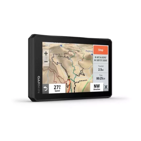
The rugged Tread off-road GPS is IPX7 weather resistant and features a glove-friendly 5.5″ touchscreen display.
Use the Tread® app1 to sync data across your various devices.
Direct-to-device BirdsEye Direct Satellite Imagery can be downloaded to Tread without a computer.
Easily install on your powersport vehicle with the included powered mount and wiring harness with tube mount.
Gear up for adventure.
OFF-ROAD RUGGEDNESS
Purpose-built for all-terrain use, Tread stands up to anything the elements can throw at it. It’s IPX7-rated for water resistance and built to U.S. military standard 810 for thermal and shock resistance.
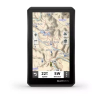
HIGH-VISIBILITY DISPLAY
With its ultrabright 5.5″ glove-friendly touchscreen, the Tread sat nav is designed for easy viewing in bright sunlight or pitch-dark. It can be mounted in portrait or landscape mode.
TRAIL NAVIGATION
Navigate unpaved roads and trails by using turn-by-turn trail navigation2 with OpenStreetMap (OSM).
TOPOGRAPHY
Tread features preloaded topographic and street maps of Europe, Africa including Tracks4Africa, Middle East, North and South America, Australia and New Zealand.
SATELLITE IMAGERY
Download high-resolution BirdsEye Direct Satellite Imagery over Wi-Fi directly to this navigation device; no annual subscription required.
Track through the outback.
EASILY SYNC YOUR DEVICES
Use the Tread app1 to sync waypoints, tracks, routes and collections across your devices, including your mobile device, computer and Tread sat nav. Easily import and share GPX files, too.
MOUNTS WITH MUSCLE
Includes a powered mount, wiring harness with tube mount and a handlebar mount to secure your Tread sat nav to the powersport vehicle for riding over rough terrain.
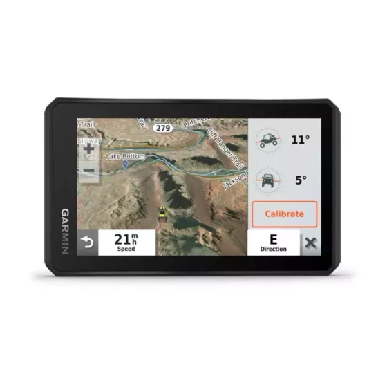
ABC SENSORS
For tough-terrain guidance, built-in sensors include an altimeter, barometer, compass and pitch/roll gauges.
INREACH® COMPATIBLE
Pair your Tread powersport sat nav with one of the compatible inReach global satellite communicators3 (sold separately) for two-way text messaging, interactive SOS and weather.
GO-ANYWHERE GUIDANCE
Spoken turn-by-turn directions if you choose to take Tread with you when you head back to civilisation and want on-road navigation.
Onboard tools for the ultimate off-road experience.
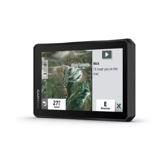
GROUP RIDE MOBILE
Pair your device with the Tread app to track your friends from your phone using the Group Ride Mobile feature.
EASY ROUTE PLANNER
Use the Tread app to easily plan routes with the same maps, vehicle profiles and route preferences that you have on the Tread device.
LIVE WEATHER
Weather ahead? Pair Tread with your compatible smartphone, and download the Tread app to access live weather, animated radar and more1.
CONTROL YOUR ACCESSORIES
Pair Tread with the compatible Garmin PowerSwitch™ digital switch box (sold separately) to enable onscreen control for your side-by-side’s 12-volt electronics — light bars, differential locks and more.
POINTS OF INTEREST
Tread comes preloaded with iOverlander points of interest so you don’t need a mobile phone signal to route to the best-established, wild and dispersed campsites.
1To use this feature, you must have the Tread app downloaded on your compatible smartphone enabled with Bluetooth technology, have an active mobile phone signal connection and pair with the Tread sat nav.
2Limitations may exist in map data for some road and trail route suggestions. Always defer to all posted road signs and conditions during vehicle operation. The Garmin OpenStreetMap products are intended to be used only as a supplementary travel aid and must not be used for any purpose requiring precise measurement of direction, distance, location or topography.
3Active satellite subscription required for the inReach device. Some jurisdictions regulate or prohibit the use of satellite communications devices. It is your responsibility to know and follow all applicable laws in the jurisdictions where the device is intended to be used.
The Bluetooth word mark and logos are registered trademarks owned by Bluetooth SIG, Inc. and any use of such marks by Garmin is under licence. Wi-Fi® is a registered trademark of the Wi-Fi Alliance. Copyright ©2021 by iOverlander, LLC.
ADD A WIRELESS CAMERA
What’s around you? Maximise visibility by pairing your Tread sat nav with a rugged BC™ 40 wireless camera with tube mount (sold separately). It easily mounts to your vehicle’s tube frame, flat panel or roll cage.
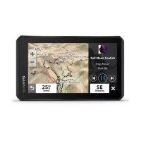
TRAVELLING MUSIC
A built-in media player lets you easily control music loaded on your compatible smartphone on the sat nav’s display — and hear your tunes through your helmet or headset (sold separately) enabled with Bluetooth technology.